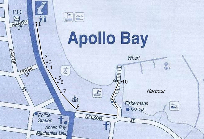
Apollo Bay History Trail
Early History
The Gadubanud (Katabanut) people occupied the rainforest plateau and rugged coastline of Cape Otway including the current towns of Lorne and Apollo Bay. By the early 1800s this area was also familiar to sealers and whalers.
In 1845 the Bay was named by Captain Loutitt after he sheltered here in his vessel "Apollo" on a voyage from Melbourne to Port Fairy.
In 1849 timber cutters commenced harvesting the trees. The first timber mills were constructed in the early 1850s and the huts built for the workers were the beginnings of a settlement close to the Barham River (Barrum-burrum).
Apollo Bay provided comparatively protected waters for anchorage. The surrounding flat and undulating land was suited for the location of the township. In 1853 it was surveyed by Skene and was named Middleton.
By the 1860s land became available for farming, by mid 1870s the first township blocks were offered for sale.
|
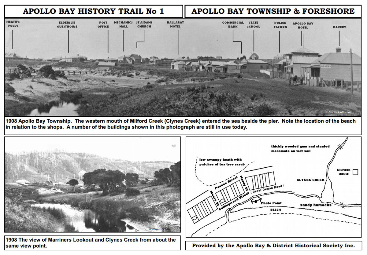
No 1. Apollo Bay Township and Foreshore The township grew following the main route along the foreshore. Most trees surrounding the town were logged prior to settlement, those remaining were ring-barked in clearing for farmland, felled and used for firewood. |
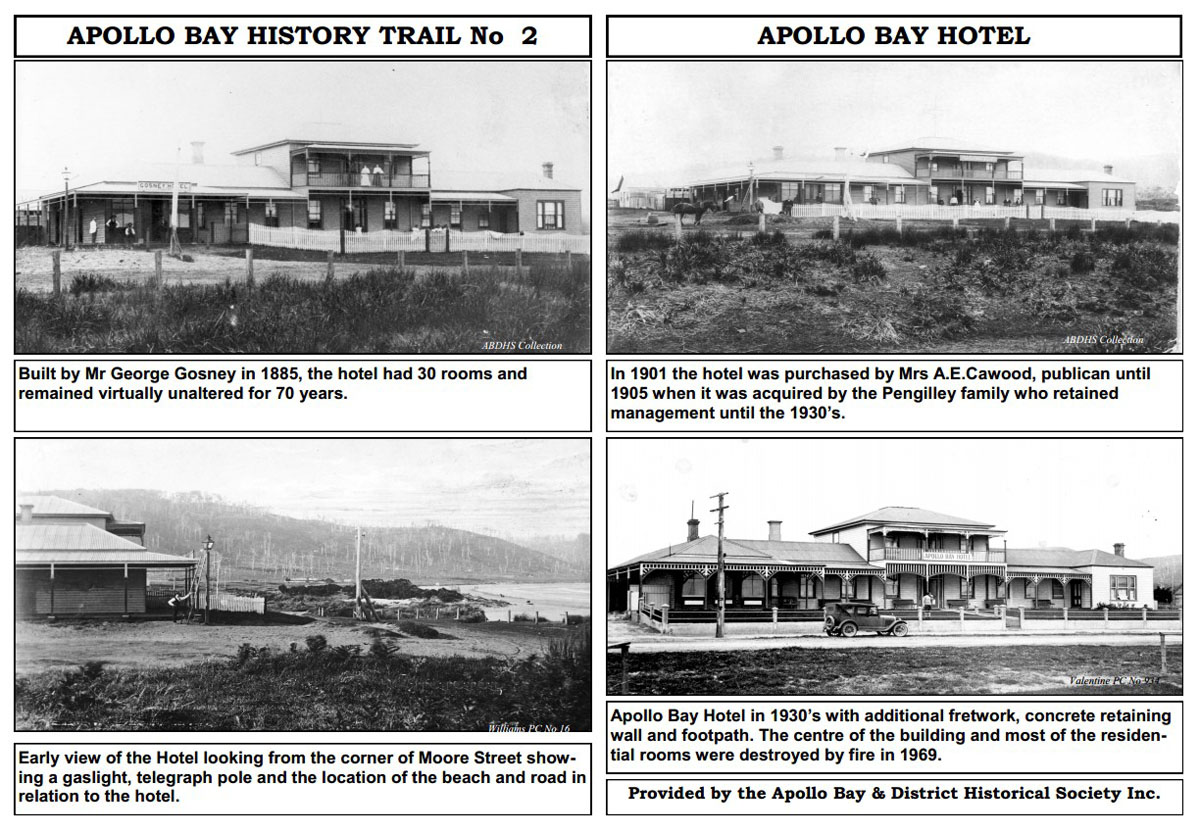
No 2. Apollo Bay Hotel In 1881 the town was named Kambruk. James Gosney sought a licence for a hotel to be called Kambruk Hall. He was granted the licence in 1886 changing the name to the Apollo Bay Hotel. Hotels at the time were the centre of the community. As well as a store, the post office and telegraph operated from the hotel until moved to Nelson Street. The first coach service between Apollo Bay and Birregurra commenced in 1889. Initiated by James Gosney and John Johnston it encouraged holiday makers to the comfortable accommodation and entertainment of the town. |
|
|
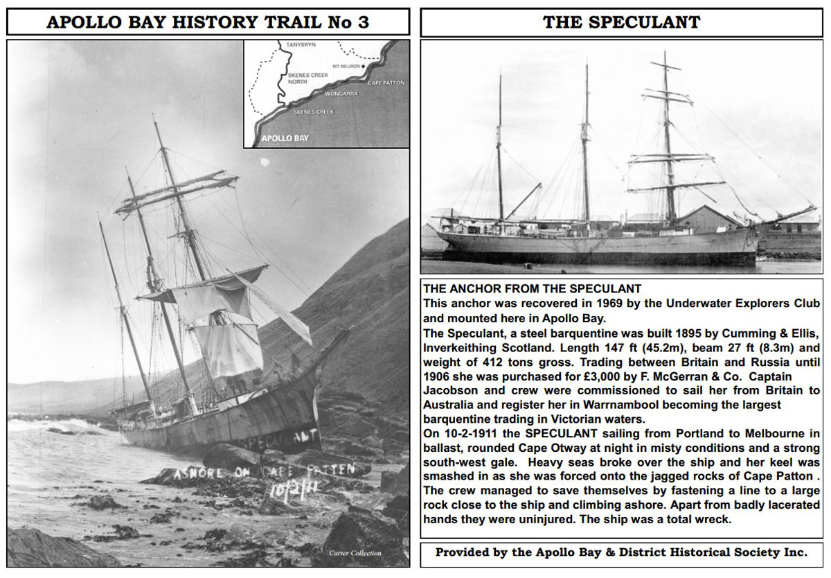
No 3. The Speculant When the Speculant was forced onto sharp rocks off Cape Patton in 1911 the crew of eight, with minor injuries they were able to climb ashore. They headed east believing Lorne to be the closest settlement but in the light of day realised their mistake and headed back towards Apollo Bay. Dressed in an assortment of underwear and night attire they were sighted by local farmer Mr C Ramsden who mistook them for escapees from the reformatory in Apollo Bay. Once he established their identity, he took them home and fed and clothed them. |
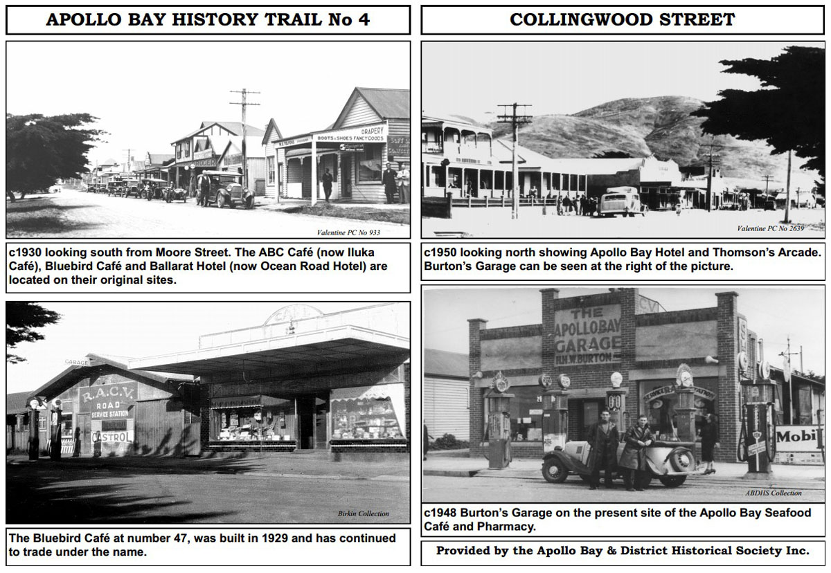
No 4. Collingwood Street In 1898 the name Kambruk was changed to Apollo Bay. Town planning indicated Pascoe Street would be the main street, however, with the erection of several buildings in Collingwood Street this became the commercial centre. The current bakery is on the same site as the one opened by Mr John Thomson in 1908. Mr Thomson did much to support the beautification of the town, with tree planting on the foreshore and streets. |
|
|
No 5. The Long Pier (Jetty) Heavy seas damaged the pier at Point Bunbury and in 1892 the Long Pier was constructed and was used for 50 years. When the roads improved in the 1930s road transport took over from the coastal vessels that had served Apollo Bay from the early settlement. Road transport opened up the fishing industry and the local fleet fished for barracoutta. The boats were limited in size to approximately 24 feet to enable them to be lifted onto the pier by crane during rough weather. |
No 6. Pier and Goods Sheds Prior to the construction of the butter factory in 1904 butter was processed on the farms and brought to the goods sheds for storage prior to shipping. |
|
|
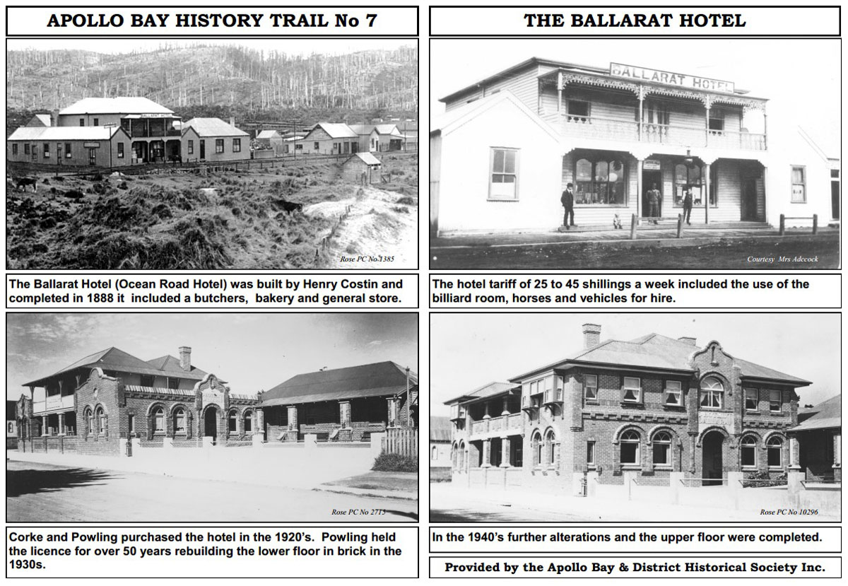
No 7. Ballarat Hotel Hotels were essentially drinking houses for both travellers and locals offering an essential service in an area of small isolated populations and adverse conditions. |
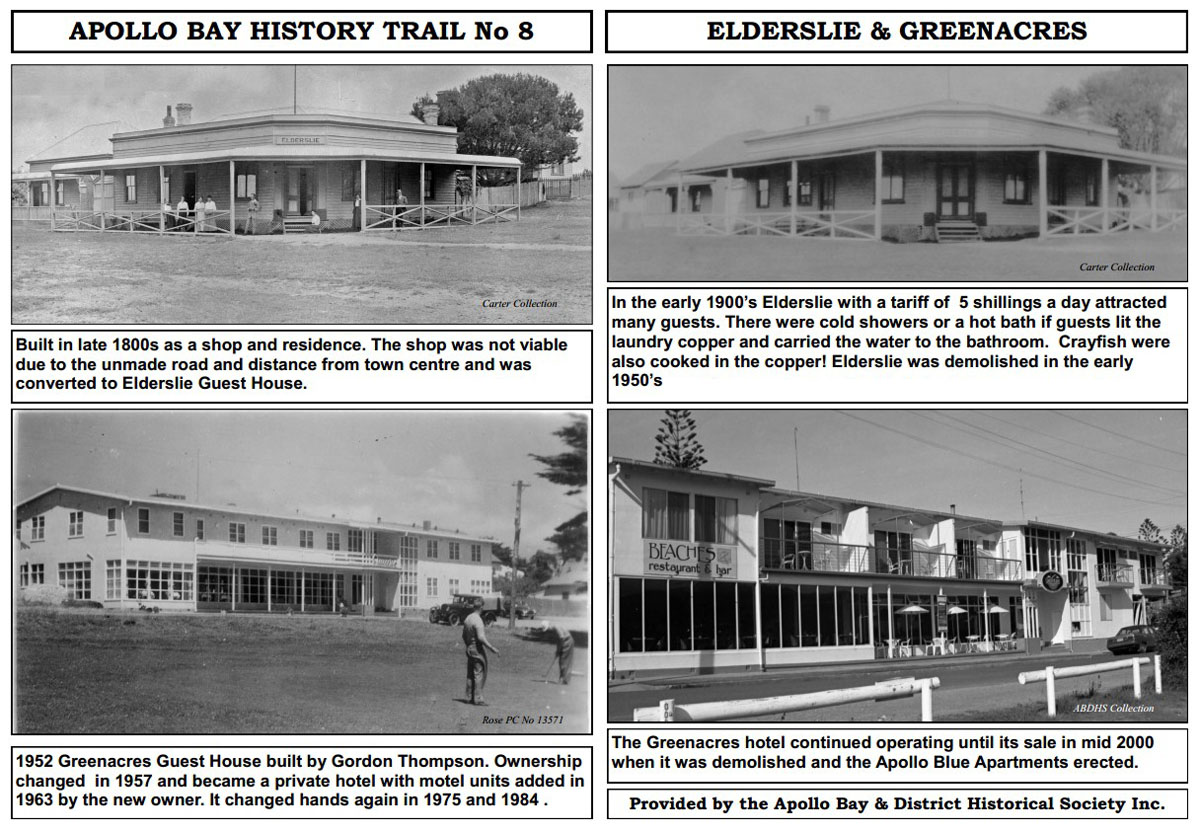
No 8. Elderslie and Greenacres Over the years Elderslie and later Greenacres were noted for the fine food served in their dining rooms. |
|
|
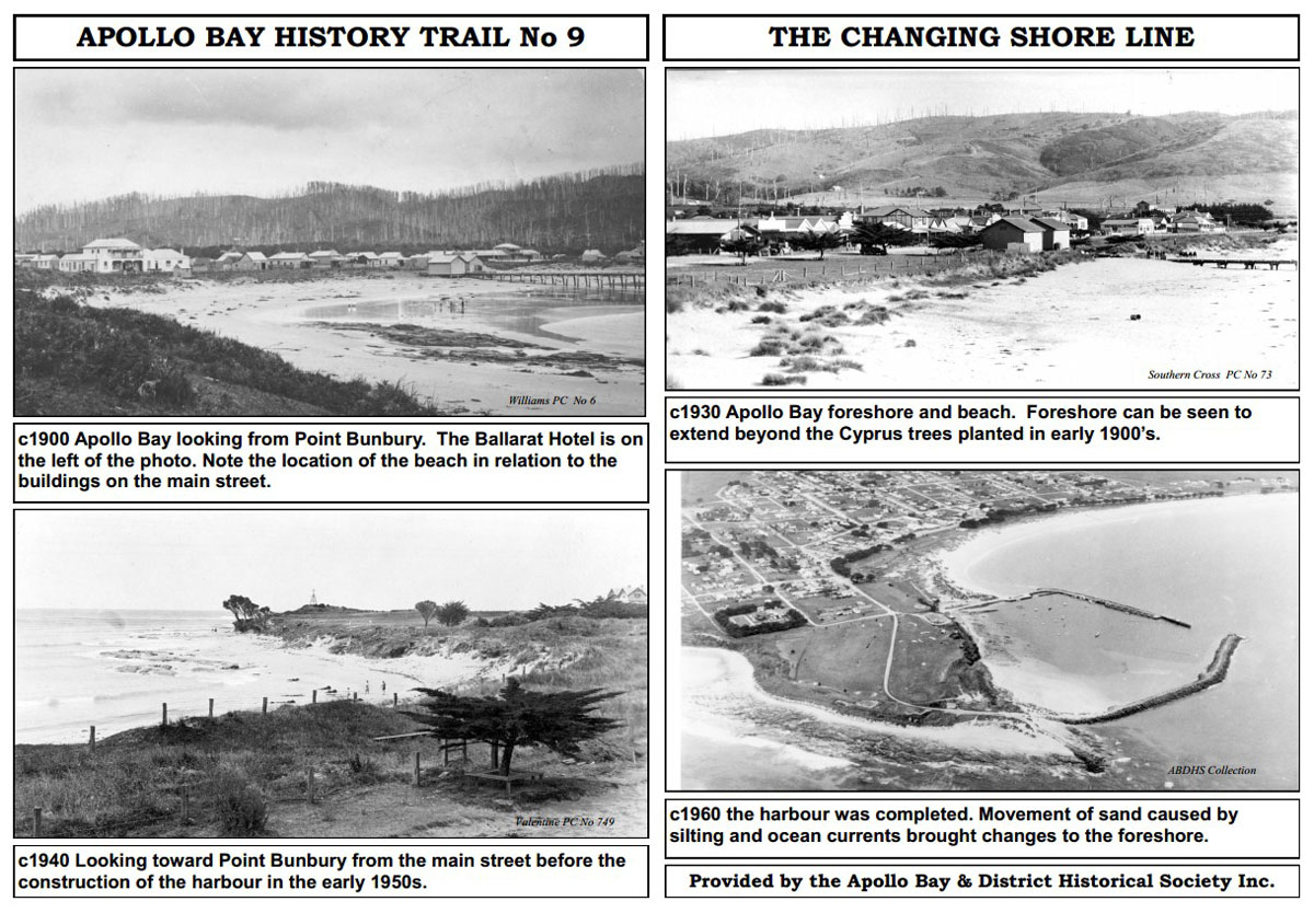
No 9. The Changing Shore Line The first and tenth holes of the golf course are now located on the dunes formed by the changing shoreline. The mouth of the harbour requires constant dredging to maintain access for boats. |
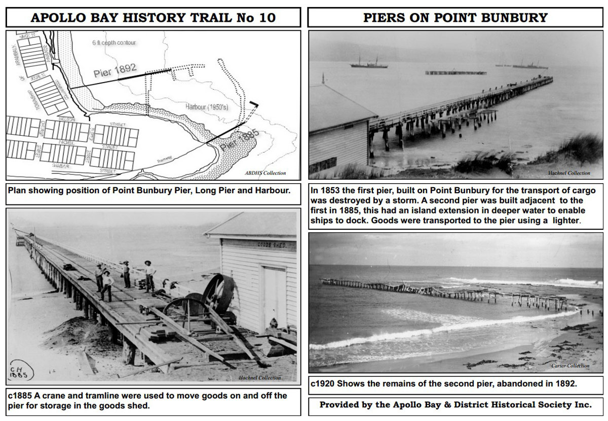
No 10. Piers on Point Bunbury The unpredictable seas caused the destruction of both piers erected on this site and lead to the construction of a new pier in 1892 in a more sheltered location. |


Provided by the Apollo Bay and District Historical Society Inc.
For more of Apollo Bay's history visit the
APOLLO BAY MUSEUM
at The Old Cable Station, 6250 Great Ocean Road
2.3 km north of the Apollo Bay Information Centre
Opening Times: Sat. 2-5pm, Sun. 10am-1pm, Public & School Holidays
Entrance fees: Adults $5, Children (8-16) $1
Cable Station and early communication
Pioneer Family Histories
Local news stories from 1840
Historical photographs