Citizen Science Coastal Monitoring
16 November 2018
Deakin University and the University of Melbourne on behalf of DELWP are working with citizen science groups using small Unmanned Aerial Vehicles (<2kg aerial drones) to monitor the shorelines within priority areas.
The project will be monitoring changes in the volume, topography and extent of beach sands and foreshore morphology.
Each Citizen Science Group is equipped with a Phantom 4 Pro drone, 3 Batteries, an iPad Mini, 10 x High accuracy GPS targets (Aeropoints) and will receive UAV Training. Pilots are required to be licensed by CASA to fly <2kg aerial drones.
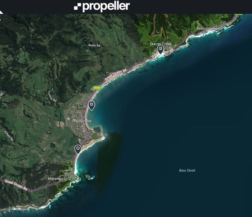
Current Citizen Science Project locations are Cape Bridgewater, Port Fairy East Beach, Warrnambool Harbour, Marengo/Mounts Bay, Apollo Bay, Skenes Creek, Anglesea, Ocean Grove, Point Lonsdale, St Leonards, Portarlington, Cowes, Inverloch & Seaspray.
The data collected is available to the community online as geo-rectified orthomosaics and volumetrics. This approach allows fast assessment of changes (if any) in the volume, height and extent of sediment and other features. To view the data collected, please visit:
Propeller Aero at https://www.propelleraero.com/ and login as
Email:
Password: propellervcmp
Select – “Show Sites from other portals” This will open the list of Victorian Sand Study Sites.
Select the site you wish to view and open Map View.
The project is always seeking interested community members to be part of the Victorian Coastal Monitoring Program. If you would like more information on possible involvement, please contact Dr Blake Allan (VCMP Citizen Science UAV Coordinator)
Ted Stuckey